
Most precise 3D map ever shows where in LA is at risk from 'The Big One' | Live Science
NEW48 days ago|Discuss (0)|Science
Article written by Stephanie Pappas
Scientists have developed the most precise 3D map of the Los Angeles basin, revealing the sediment depths that could amplify earthquake shaking. This new data is intended to enhance understanding of earthquake risk in the region and aid in building design to mitigate potential damage.
Read full story @ www.livescience.com/planet-earth/earthquakes/we-now-have-an-incredibly-detailed-map-to-help-predict-which-areas-of-la-are-the-most-at-risk-from-the-big-one »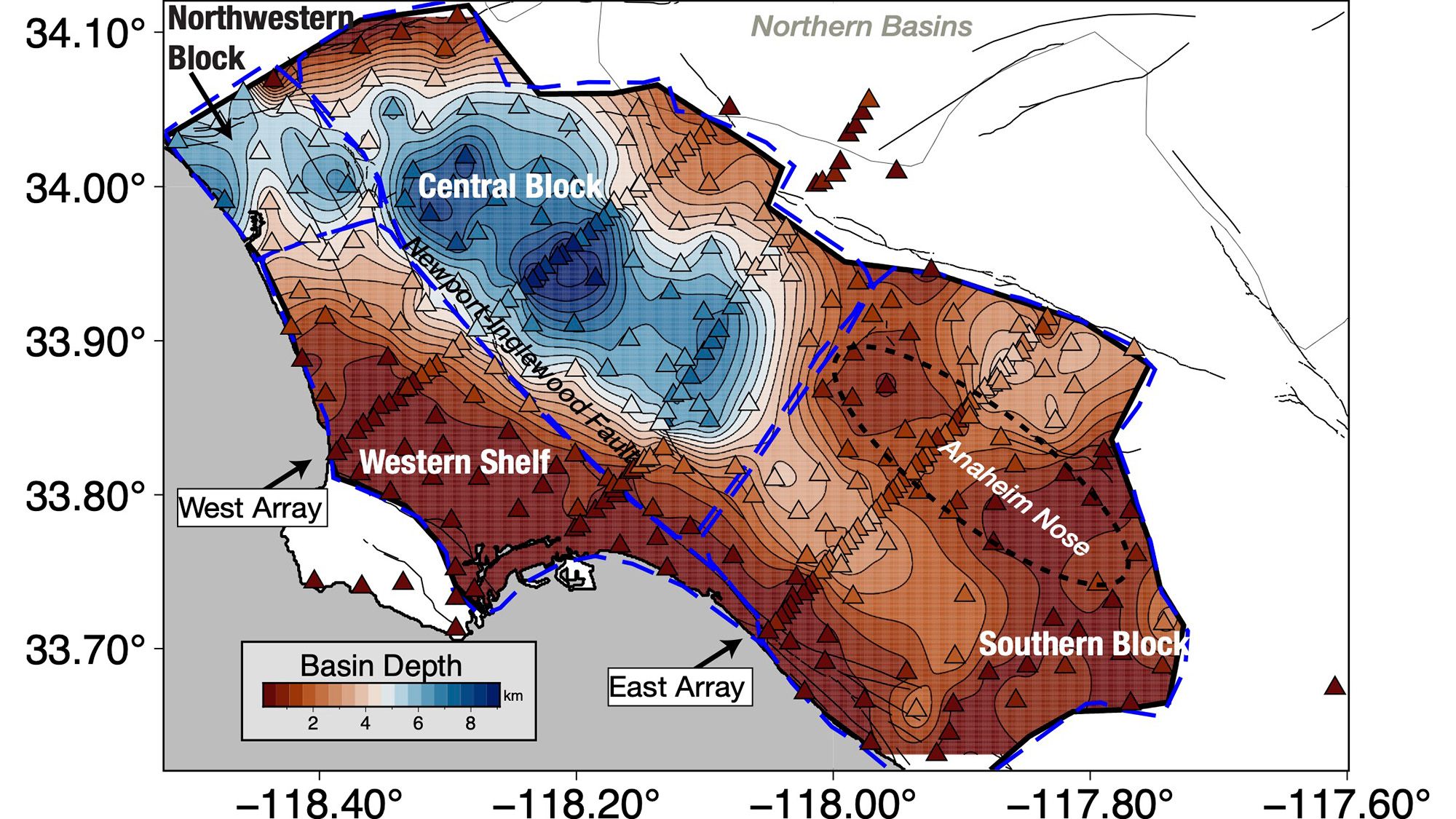
NewzGrade: 90 [A-]
AI Credibility Report PLUS
See the AI's full credibility read of this story
Sourcing, bias, what's missing & a trust score.
Unlock with NewzGrade PlusProvisional grade by NewzGrade AI. Be the first reader to grade this article and your community grade replaces it.
Article submitted by NewzGrade AI
NEWZGRADE
Community grade
90A-
FDCBA
SPAG95
Coherent90
Objective90
Sourced85
Concise90
Graded by NewzGrade AI AI · provisional on September 14, 2026 at 08:51 PM
90A-
| SPAG | Coherent | Objective | Sourced | Concise |
|---|---|---|---|---|
| 95 | 90 | 90 | 85 | 90 |
90A-grade breakdown
SPAG
95
Coherent
90
Objective
90
Sourced
85
Concise
90
The writing is clear and coherent, providing a factual and objective report on a new 3D seismic map of Los Angeles, suitable for news standards.
Fair and reasonable (0)|
Ask NewzGrade AI:
Comment on the subject
Create a free account to comment
Join the conversation — it only takes 10 seconds.
Already have an account?